
杭集镇 topographic map
Interactive map
Click on the map to display elevation.
About this map
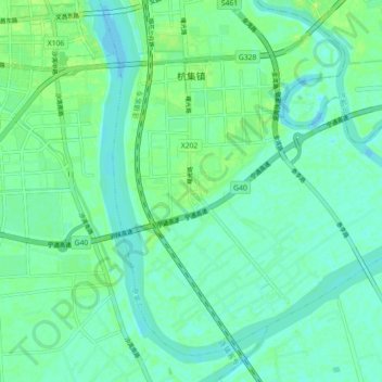
Name: 杭集镇 topographic map, elevation, terrain.
Location: 杭集镇, 广陵区, 扬州市, 江苏省, 225000, 中国 (32.33107 119.51580 32.39618 119.60492)
Average elevation: 5 m
Minimum elevation: 0 m
Maximum elevation: 13 m