
Thank you for supporting this site ❤️
Make a donation
Make a donation
Gear up for your next adventure:
As an Amazon Associate, this site earns from qualifying purchases at no extra cost to you.
Grub topographic map
Click on the map to display elevation.
Thank you for supporting this site ❤️
Make a donation
Make a donation
Gear up for your next adventure:
As an Amazon Associate, this site earns from qualifying purchases at no extra cost to you.
About this map
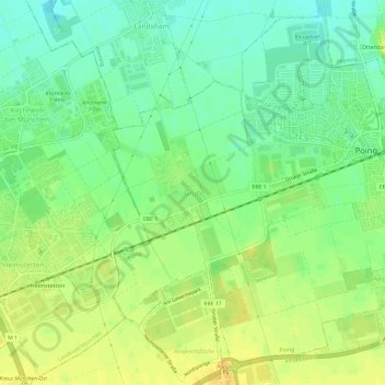
Name: Grub topographic map, elevation, terrain.
Location: Grub, Poing, Landkreis Ebersberg, Bayern, 85586, Deutschland (48.14765 11.76202 48.18765 11.80202)
Average elevation: 516 m
Minimum elevation: 502 m
Maximum elevation: 530 m
Thank you for supporting this site ❤️
Make a donation
Make a donation
Gear up for your next adventure:
As an Amazon Associate, this site earns from qualifying purchases at no extra cost to you.