
Churchill County topographic map
Interactive map
Click on the map to display elevation.
About this map
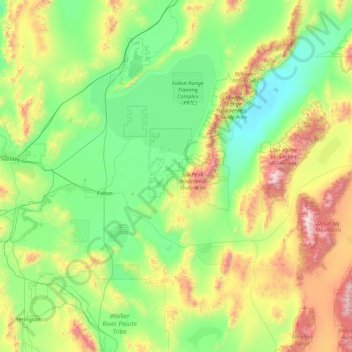
Name: Churchill County topographic map, elevation, terrain.
Location: Churchill County, Nevada, Verenigde Staten van Amerika (39.07364 -119.22574 40.00304 -117.46018)
Average elevation: 1,476 m
Minimum elevation: 1,029 m
Maximum elevation: 3,027 m
Other topographic maps
Click on a map to view its topography, its elevation and its terrain.
Nye County
Verenigde Staten van Amerika > Nevada
Nye County, Nevada, Verenigde Staten van Amerika
Average elevation: 1,620 m