
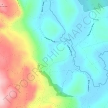
Aghakeeran topographic map
Interactive map
Click on the map to display elevation.
About this map
Name: Aghakeeran topographic map, elevation, terrain.
Average elevation: 124 m
Minimum elevation: 48 m
Maximum elevation: 294 m
Other topographic maps
Click on a map to view its topography, its elevation and its terrain.
Drumadown
Royaume-Uni > Irlande du Nord > Derrygonnelly
Drumadown, Rahalton ED, Derrygonnelly, County Fermanagh, Irlande du Nord, Royaume-Uni
Average elevation: 110 m
Drumary
Royaume-Uni > Irlande du Nord > Derrygonnelly
Drumary, Doagh ED, Derrygonnelly, County Fermanagh, Irlande du Nord, Royaume-Uni
Average elevation: 74 m