
Thank you for supporting this site ❤️
Make a donation
Make a donation
Gear up for your next adventure:
As an Amazon Associate, this site earns from qualifying purchases at no extra cost to you.
Tiantai County topographic map
Click on the map to display elevation.
Thank you for supporting this site ❤️
Make a donation
Make a donation
Gear up for your next adventure:
As an Amazon Associate, this site earns from qualifying purchases at no extra cost to you.
About this map
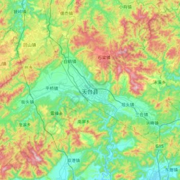
Name: Tiantai County topographic map, elevation, terrain.
Location: Tiantai County, Taizhou, 花前产业园区, Zhejiang, China (28.95436 120.68559 29.34700 121.25976)
Average elevation: 348 m
Minimum elevation: 6 m
Maximum elevation: 1,207 m
Thank you for supporting this site ❤️
Make a donation
Make a donation
Gear up for your next adventure:
As an Amazon Associate, this site earns from qualifying purchases at no extra cost to you.