
Thank you for supporting this site ❤️
Make a donation
Make a donation
Gear up for your next adventure:
As an Amazon Associate, this site earns from qualifying purchases at no extra cost to you.
Daniels topographic map
Click on the map to display elevation.
Thank you for supporting this site ❤️
Make a donation
Make a donation
Gear up for your next adventure:
As an Amazon Associate, this site earns from qualifying purchases at no extra cost to you.
About this map
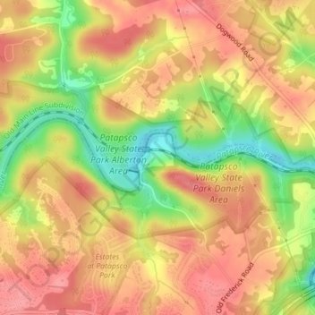
Name: Daniels topographic map, elevation, terrain.
Location: Daniels, Howard County, Maryland, 20140, United States (39.30591 -76.82385 39.32591 -76.80385)
Average elevation: 116 m
Minimum elevation: 61 m
Maximum elevation: 149 m
Thank you for supporting this site ❤️
Make a donation
Make a donation
Gear up for your next adventure:
As an Amazon Associate, this site earns from qualifying purchases at no extra cost to you.
Other topographic maps
Click on a map to view its topography, its elevation and its terrain.
Patapsco Valley State Park
United States > Maryland > Howard County > Ilchester
Average elevation: 131 m