
Make a donation
Gear up for your next adventure:
As an Amazon Associate, this site earns from qualifying purchases at no extra cost to you.
Pallasbeg topographic map
Click on the map to display elevation.
Make a donation
Gear up for your next adventure:
As an Amazon Associate, this site earns from qualifying purchases at no extra cost to you.
About this map
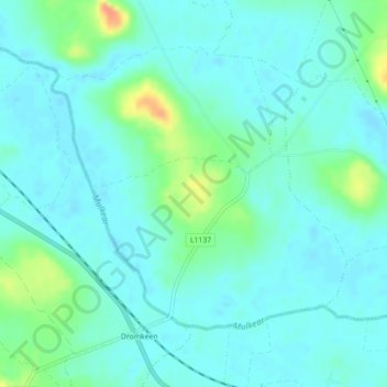
Name: Pallasbeg topographic map, elevation, terrain.
Average elevation: 49 m
Minimum elevation: 40 m
Maximum elevation: 80 m
County Limerick trails, hiking, mountain biking, running and outdoor activities
Make a donation
Gear up for your next adventure:
As an Amazon Associate, this site earns from qualifying purchases at no extra cost to you.
Other topographic maps
Click on a map to view its topography, its elevation and its terrain.
Kilcruaig
Ireland > County Limerick > The Municipal District of Cappamore — Kilmallock
Average elevation: 200 m
Knockadea
Ireland > County Limerick > The Municipal District of Cappamore — Kilmallock
Average elevation: 203 m
Pallasgreen
Ireland > County Limerick > The Municipal District of Cappamore — Kilmallock
Average elevation: 72 m
Galtymore
Ireland > County Limerick > The Municipal District of Cappamore — Kilmallock
Galtymore or Galteemore (Irish: Cnoc Mór na nGaibhlte, meaning 'big hill of the Galtees') is a mountain in the province of Munster, Ireland. At 917.9 metres (3,011 ft 6 in), it is one of Ireland's highest mountains, being the 12th-highest on the Arderin list, and 14th-highest on the Vandeleur-Lynam list.…
Average elevation: 594 m
Make a donation
Gear up for your next adventure:
As an Amazon Associate, this site earns from qualifying purchases at no extra cost to you.
Aherlow
Ireland > County Limerick > The Municipal District of Cappamore — Kilmallock
Average elevation: 141 m
Clare Glens
Ireland > County Limerick > The Municipal District of Cappamore — Kilmallock
Average elevation: 124 m
Ardpatrick
Ireland > County Limerick > The Municipal District of Cappamore — Kilmallock
Average elevation: 169 m
Bruff
Ireland > County Limerick > The Municipal District of Cappamore — Kilmallock
Average elevation: 68 m
Make a donation
Gear up for your next adventure:
As an Amazon Associate, this site earns from qualifying purchases at no extra cost to you.
Bruree
Ireland > County Limerick > The Municipal District of Cappamore — Kilmallock
Average elevation: 62 m