
Thank you for supporting this site ❤️
Make a donation
Make a donation
Gear up for your next adventure:
As an Amazon Associate, this site earns from qualifying purchases at no extra cost to you.
Manjuyod topographic map
Click on the map to display elevation.
Thank you for supporting this site ❤️
Make a donation
Make a donation
Gear up for your next adventure:
As an Amazon Associate, this site earns from qualifying purchases at no extra cost to you.
About this map
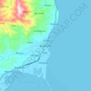
Name: Manjuyod topographic map, elevation, terrain.
Location: Manjuyod, Negros Oriental, Central Visayas, Philippines (9.63885 123.10881 9.71885 123.18881)
Average elevation: 72 m
Minimum elevation: 0 m
Maximum elevation: 630 m
Thank you for supporting this site ❤️
Make a donation
Make a donation
Gear up for your next adventure:
As an Amazon Associate, this site earns from qualifying purchases at no extra cost to you.