
Thank you for supporting this site ❤️
Make a donation
Make a donation
Gear up for your next adventure:
As an Amazon Associate, this site earns from qualifying purchases at no extra cost to you.
Lingshui Li Autonomous County topographic map
Click on the map to display elevation.
Thank you for supporting this site ❤️
Make a donation
Make a donation
Gear up for your next adventure:
As an Amazon Associate, this site earns from qualifying purchases at no extra cost to you.
About this map
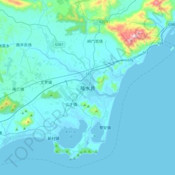
Name: Lingshui Li Autonomous County topographic map, elevation, terrain.
Location: Lingshui Li Autonomous County, Hainan Province, China (18.34710 109.87313 18.66710 110.19313)
Average elevation: 62 m
Minimum elevation: -2 m
Maximum elevation: 922 m
Thank you for supporting this site ❤️
Make a donation
Make a donation
Gear up for your next adventure:
As an Amazon Associate, this site earns from qualifying purchases at no extra cost to you.