
Nakuru topographic map
Interactive map
Click on the map to display elevation.
About this map
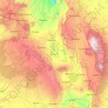
Name: Nakuru topographic map, elevation, terrain.
Location: Nakuru, Kenya (-1.15469 35.41450 0.23363 36.59833)
Average elevation: 2,237 m
Minimum elevation: 986 m
Maximum elevation: 3,971 m
Other topographic maps
Click on a map to view its topography, its elevation and its terrain.
Nairobi Area
Kenya > Nakuru > Nakuru East > Nakuru
Nairobi Area, Nakuru, Nakuru East, Nakuru, Rift Valley, Kenya
Average elevation: 1,847 m