Geolocate

Carlow topographic map

Click on the map to display elevation.

About this map

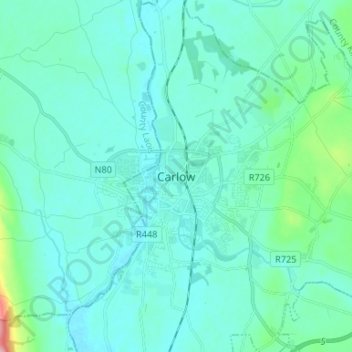
Name: Carlow topographic map, elevation, terrain.

Location: Carlow, County Carlow, Leinster, R93 V960, Ireland (52.80083 -6.96611 52.88083 -6.88611)

Average elevation: 63 m

Minimum elevation: 43 m

Maximum elevation: 204 m

Ireland trails, hiking, mountain biking, running and outdoor activities

Gear up for your next adventure:

🥽UV Protection Sunglasses - Protect eyes on bright days
🔨Multi-tool Devices - Versatile tools for gear repairs in the field
📍Handheld GPS Devices - Accurate GPS units for mapping and navigation
🎿Skiing Gear - Winter sports essentials
🧤Thermal Gloves - Warm gloves for cold weather

As an Amazon Associate, this site earns from qualifying purchases at no extra cost to you.