

San Ramon topographic map
Click on the map to display elevation.
San Ramon
The topography of San Ramon is varied, featuring a mix of the rolling hills of the Diablo Range and the flatter basin of the San Ramon Valley. The city is predominantly urban and residential with many new housing developments; however, much of the land around the city's perimeter regions remains undeveloped, and is covered by grasslands and oak tree orchards. During the drier months the grasses are golden, but with the precipitation of winter and spring, the grasses turn green.
About this map
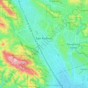
Name: San Ramon topographic map, elevation, terrain.
Location: San Ramon, Contra Costa County, California, United States (37.72124 -122.00448 37.79512 -121.87693)
Average elevation: 210 m
Minimum elevation: 101 m
Maximum elevation: 560 m