
Thank you for supporting this site ❤️
Make a donation
Make a donation
Gear up for your next adventure:
As an Amazon Associate, this site earns from qualifying purchases at no extra cost to you.
Huayhuas topographic map
Click on the map to display elevation.
Thank you for supporting this site ❤️
Make a donation
Make a donation
Gear up for your next adventure:
As an Amazon Associate, this site earns from qualifying purchases at no extra cost to you.
About this map
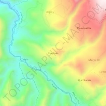
Name: Huayhuas topographic map, elevation, terrain.
Location: Huayhuas, Acos Vinchos, Huamanga, Ayacucho, Perú (-13.17800 -74.10019 -13.13800 -74.06019)
Average elevation: 2,942 m
Minimum elevation: 2,631 m
Maximum elevation: 3,365 m
Thank you for supporting this site ❤️
Make a donation
Make a donation
Gear up for your next adventure:
As an Amazon Associate, this site earns from qualifying purchases at no extra cost to you.