Geolocate

Wakiso topographic map

Interactive map

Click on the map to display elevation.

About this map

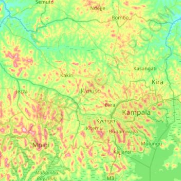
Name: Wakiso topographic map, elevation, terrain.

Location: Wakiso, Central Region, Uganda (-0.15018 32.19150 0.58697 32.68632)

Average elevation: 1,156 m

Minimum elevation: 1,075 m

Maximum elevation: 1,360 m

Other topographic maps

Click on a map to view its topography, its elevation and its terrain.

Entebbe City

Uganda > Wakiso

Entebbe City, Wakiso, Central Region, Uganda

Average elevation: 1,146 m

Nansana

Uganda > Wakiso > Nansana

Nansana, Wakiso, Central Region, 7051, Uganda

Average elevation: 1,172 m

Gombe

Uganda > Wakiso > Gombe

Gombe, Wakiso, Central Region, Uganda

Average elevation: 1,161 m

Entebbe

Uganda > Wakiso > Entebbe

Entebbe, Wakiso, Central Region, 16, Uganda

Average elevation: 1,146 m