
Narayanganj topographic map
Interactive map
Click on the map to display elevation.
About this map
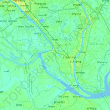
Name: Narayanganj topographic map, elevation, terrain.
Location: Narayanganj, Narayanganj District, Dhaka Division, Bangladesh (23.54578 90.43179 23.70924 90.53469)
Average elevation: 6 m
Minimum elevation: -4 m
Maximum elevation: 19 m
Other topographic maps
Click on a map to view its topography, its elevation and its terrain.