
Thank you for supporting this site ❤️
Make a donation
Make a donation
Gear up for your next adventure:
As an Amazon Associate, this site earns from qualifying purchases at no extra cost to you.
Shule topographic map
Click on the map to display elevation.
Thank you for supporting this site ❤️
Make a donation
Make a donation
Gear up for your next adventure:
As an Amazon Associate, this site earns from qualifying purchases at no extra cost to you.
About this map
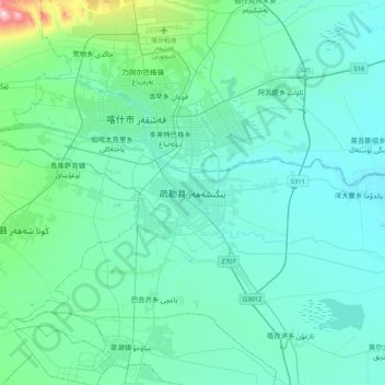
Name: Shule topographic map, elevation, terrain.
Location: Shule, Shule County, Kashgar Prefecture, Xinjiang, China (39.24498 75.89106 39.56498 76.21106)
Average elevation: 1,294 m
Minimum elevation: 1,240 m
Maximum elevation: 1,712 m
Thank you for supporting this site ❤️
Make a donation
Make a donation
Gear up for your next adventure:
As an Amazon Associate, this site earns from qualifying purchases at no extra cost to you.