
Dunmanway Poor Law Union topographic map
Interactive map
Click on the map to display elevation.
About this map
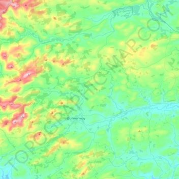
Name: Dunmanway Poor Law Union topographic map, elevation, terrain.
Location: Dunmanway Poor Law Union, County Cork, Munster, Ireland (51.64769 -9.35959 51.87924 -8.91990)
Average elevation: 146 m
Minimum elevation: 19 m
Maximum elevation: 538 m
County Cork trails, hiking, mountain biking, running and outdoor activities
Other topographic maps
Click on a map to view its topography, its elevation and its terrain.