
Thank you for supporting this site ❤️
Make a donation
Make a donation
Gear up for your next adventure:
As an Amazon Associate, this site earns from qualifying purchases at no extra cost to you.
Andis topographic map
Click on the map to display elevation.
Thank you for supporting this site ❤️
Make a donation
Make a donation
Gear up for your next adventure:
As an Amazon Associate, this site earns from qualifying purchases at no extra cost to you.
About this map
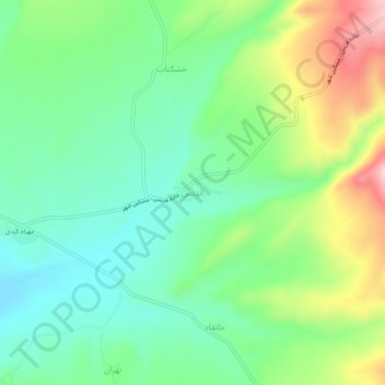
Name: Andis topographic map, elevation, terrain.
Location: Andis, بخش مرکزی, Heris County, East Azerbaijan Province, Iran (38.20039 47.18556 38.24039 47.22556)
Average elevation: 1,938 m
Minimum elevation: 1,852 m
Maximum elevation: 2,110 m
Thank you for supporting this site ❤️
Make a donation
Make a donation
Gear up for your next adventure:
As an Amazon Associate, this site earns from qualifying purchases at no extra cost to you.