
Thank you for supporting this site ❤️
Make a donation
Make a donation
Gear up for your next adventure:
As an Amazon Associate, this site earns from qualifying purchases at no extra cost to you.
Sugar topographic map
Click on the map to display elevation.
Thank you for supporting this site ❤️
Make a donation
Make a donation
Gear up for your next adventure:
As an Amazon Associate, this site earns from qualifying purchases at no extra cost to you.
About this map
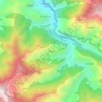
Name: Sugar topographic map, elevation, terrain.
Location: Sugar, Gairsain, Chamoli District, Uttarakhand, 246440, India (30.11724 79.20928 30.15724 79.24928)
Average elevation: 1,689 m
Minimum elevation: 1,212 m
Maximum elevation: 2,331 m
Thank you for supporting this site ❤️
Make a donation
Make a donation
Gear up for your next adventure:
As an Amazon Associate, this site earns from qualifying purchases at no extra cost to you.