
Thank you for supporting this site ❤️
Make a donation
Make a donation
Gear up for your next adventure:
As an Amazon Associate, this site earns from qualifying purchases at no extra cost to you.
Uenuni topographic map
Click on the map to display elevation.
Thank you for supporting this site ❤️
Make a donation
Make a donation
Gear up for your next adventure:
As an Amazon Associate, this site earns from qualifying purchases at no extra cost to you.
About this map
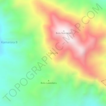
Name: Uenuni topographic map, elevation, terrain.
Location: Uenuni, Sigi Regency, Central Sulawesi, Indonesia (-1.28351 120.14163 -1.24351 120.18163)
Average elevation: 1,734 m
Minimum elevation: 1,258 m
Maximum elevation: 2,357 m
Thank you for supporting this site ❤️
Make a donation
Make a donation
Gear up for your next adventure:
As an Amazon Associate, this site earns from qualifying purchases at no extra cost to you.