Geolocate

Dougherty topographic map

Click on the map to display elevation.

About this map
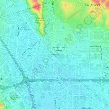
Name: Dougherty topographic map, elevation, terrain.

Location: Dougherty, Dublin, Alameda County, California, 94588, United States (37.69104 -121.92968 37.73104 -121.88968)

Average elevation: 112 m

Minimum elevation: 97 m

Maximum elevation: 184 m

Other topographic maps

Click on a map to view its topography, its elevation and its terrain.

Gear up for your next adventure:

🔋Rechargeable Batteries - Eco-friendly power for headlamps and GPS units
🔥Camping Stoves - Portable camping stoves for outdoor cooking
⛷️Mountain Sports Accessories - Gear for high intensity outdoor sports
🧴Hiking Sunscreen - Sun protection for long exposure
🧗Climbing Gear - Essential equipment for climbing routes

As an Amazon Associate, this site earns from qualifying purchases at no extra cost to you.