
Mountain Province topographic map
Interactive map
Click on the map to display elevation.
About this map
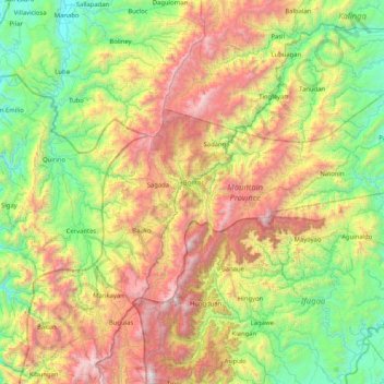
Name: Mountain Province topographic map, elevation, terrain.
Average elevation: 1,037 m
Minimum elevation: 82 m
Maximum elevation: 2,814 m
Other topographic maps
Click on a map to view its topography, its elevation and its terrain.
Agawa River
Philippines > Mountain Province
Agawa River, Mountain Province, Cordillera Administrative Region, 2618, Philippines
Average elevation: 1,318 m