Geolocate

La Rimá topographic map

Click on the map to display elevation.

About this map

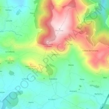
Name: La Rimá topographic map, elevation, terrain.

Location: La Rimá, Sariego, Asturias, 33518, Spain (43.40504 -5.61450 43.44504 -5.57450)

Average elevation: 411 m

Minimum elevation: 221 m

Maximum elevation: 730 m

Gear up for your next adventure:

🗺️Topographic Maps - Detailed maps for hiking, cycling and planning routes
📍Handheld GPS Devices - Accurate GPS units for mapping and navigation
🌂Windproof Trekking Umbrellas - Protection during vertical Irish rain
🧣Multi-functional Neckwear - Protect against wind and sun with versatile Buffs
🏕️Camping Chairs - Comfortable outdoor chairs for campsites

As an Amazon Associate, this site earns from qualifying purchases at no extra cost to you.