Geolocate

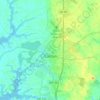
Chaple topographic map

Click on the map to display elevation.

About this map

Name: Chaple topographic map, elevation, terrain.

Location: Chaple, Talbot County, Maryland, 21625, United States (38.83484 -76.03022 38.85484 -76.01022)

Average elevation: 20 m

Minimum elevation: 12 m

Maximum elevation: 25 m

Other topographic maps

Click on a map to view its topography, its elevation and its terrain.
Easton

United States > Maryland > Talbot County

Average elevation: 10 m

Easton

United States > Maryland > Talbot County

Average elevation: 10 m

Gear up for your next adventure:

⌚Solar Multisport Watches - Advanced mapping and GPS tracking for endurance hikers
🍖High-Protein Trail Snacks - Lightweight fuel for long distance treks
🌄Sun Protection Gear - Gear to shield from strong sun
🛶Inflatable Touring Kayaks - Explore Irish loughs and coastal topography
🎒Technical Hiking Daypacks - Ergonomic backpacks with hydration bladder compatibility

As an Amazon Associate, this site earns from qualifying purchases at no extra cost to you.