Geolocate

Kenton topographic map

Click on the map to display elevation.

About this map
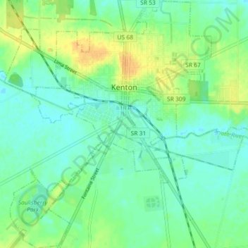
Name: Kenton topographic map, elevation, terrain.

Location: Kenton, Hardin County, Ohio, 43326, United States (40.61249 -83.64375 40.66685 -83.57455)

Average elevation: 299 m

Minimum elevation: 289 m

Maximum elevation: 317 m

Other topographic maps

Click on a map to view its topography, its elevation and its terrain.

Grant

United States > Ohio > Hardin County

Average elevation: 284 m

Gear up for your next adventure:

🧶Camping String Lights - Ambience and utility lighting
🛶Inflatable Touring Kayaks - Explore Irish loughs and coastal topography
📊Altimeters & Barometers - Track elevation and weather changes
🔒Outdoor Gear Locks - Secure your equipment
🥛Insulated Flasks - Keep drinks hot or cold

As an Amazon Associate, this site earns from qualifying purchases at no extra cost to you.