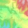
Western Port topographic map
Click on the map to display elevation.
Western Port
Formerly a major river drainage system, it was inundated together with Port Phillip by the rising sea in the Holocene period; the Western Port sunkland now forms an extensive tidal bay. The waters of Western Port cover an area of 680 km² of which 270 km² are exposed as mud flats at low tide. The topography of Western Port is dominated by two large islands: French Island and Phillip Island. The coastline, including that of the islands, is some 263 km. The bay and its islands are criss-crossed by seven seismically active fault lines and experiences numerous minor earthquakes every year.
About this map

Name: Western Port topographic map, elevation, terrain.
Location: Western Port, Victoria, 3923, Australia (-38.55089 145.02535 -38.21378 145.55248)
Average elevation: 35 m
Minimum elevation: -1 m
Maximum elevation: 298 m
Other topographic maps
Click on a map to view its topography, its elevation and its terrain.


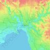
Melbourne
Melbourne is also prone to isolated convective showers forming when a cold pool crosses the state, especially if there is considerable daytime heating. These showers are often heavy and can include hail, squalls, and significant drops in temperature, but they often pass through very quickly with a rapid…
Average elevation: 49 m



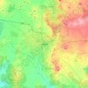
Ballarat
Ballarat has a moderate oceanic climate (Köppen climate classification Cfb) with four distinct seasons. Its elevation, ranging between 400 and 630 metres (1,310 and 2,070 feet) above sea level, causes its mean monthly temperatures to tend to be on average 3 to 5 °C (5 to 9 °F) below those of Melbourne,…
Average elevation: 470 m







Lilydale-Warburton Rail Trail
Australia > Victoria > Melbourne > Woori Yallock
Average elevation: 105 m
Dandenong Ranges
Australia > Victoria > Melbourne
The topography consists of a series of ridges dissected by deeply cut streams. Sheltered gullies in the south of the range are home to temperate rain forest, fern gullies and Mountain Ash forest Eucalyptus regnans, whereas the drier ridges and exposed northern slopes are covered by dry sclerophyll forest of…
Average elevation: 456 m















Castlemaine
The Castlemaine goldfields' legendary prosperity raised expectations of Castlemaine becoming Victoria's second city. That is reflected in imposing buildings erected in the town's first few years. Though the rich alluvial diggings were largely exhausted within 15-20 years causing the town's population to shrink…
Average elevation: 331 m


Mount Noorat
Mount Noorat is a major volcano of the Newer Volcanics Province of Victoria, with a peak height of 310 metres above sea level and a crater between 160 and 200 metres. It is characterised by multiple vents, a complex topography, and the deepest scoria enclosed crater in Victoria. The mount illustrates a…
Average elevation: 176 m