
Thank you for supporting this site ❤️
Make a donation
Make a donation
Gear up for your next adventure:
As an Amazon Associate, this site earns from qualifying purchases at no extra cost to you.
Olderdalen topographic map
Click on the map to display elevation.
Thank you for supporting this site ❤️
Make a donation
Make a donation
Gear up for your next adventure:
As an Amazon Associate, this site earns from qualifying purchases at no extra cost to you.
About this map
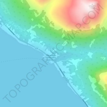
Name: Olderdalen topographic map, elevation, terrain.
Location: Olderdalen, Kåfjord, Troms og Finnmark, 9146, Norway (69.58459 20.52017 69.62459 20.56017)
Average elevation: 212 m
Minimum elevation: -2 m
Maximum elevation: 1,157 m
Thank you for supporting this site ❤️
Make a donation
Make a donation
Gear up for your next adventure:
As an Amazon Associate, this site earns from qualifying purchases at no extra cost to you.