
Thank you for supporting this site ❤️
Make a donation
Make a donation
Gear up for your next adventure:
As an Amazon Associate, this site earns from qualifying purchases at no extra cost to you.
Bonolva/Bonorva topographic map
Click on the map to display elevation.
Thank you for supporting this site ❤️
Make a donation
Make a donation
Gear up for your next adventure:
As an Amazon Associate, this site earns from qualifying purchases at no extra cost to you.
About this map
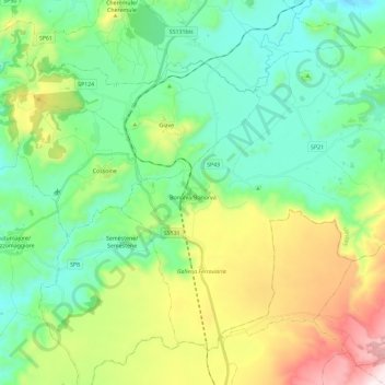
Name: Bonolva/Bonorva topographic map, elevation, terrain.
Location: Bonolva/Bonorva, Sassari, Sardinia, 07012, Italy (40.34865 8.72514 40.49320 8.95666)
Average elevation: 512 m
Minimum elevation: 274 m
Maximum elevation: 1,084 m
Thank you for supporting this site ❤️
Make a donation
Make a donation
Gear up for your next adventure:
As an Amazon Associate, this site earns from qualifying purchases at no extra cost to you.
Other topographic maps
Click on a map to view its topography, its elevation and its terrain.