
Thank you for supporting this site ❤️
Make a donation
Make a donation
Gear up for your next adventure:
As an Amazon Associate, this site earns from qualifying purchases at no extra cost to you.
Comuna 3 topographic map
Click on the map to display elevation.
Thank you for supporting this site ❤️
Make a donation
Make a donation
Gear up for your next adventure:
As an Amazon Associate, this site earns from qualifying purchases at no extra cost to you.
About this map
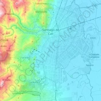
Name: Comuna 3 topographic map, elevation, terrain.
Location: Comuna 3, Cali, Sur, Valle del Cauca, Colombia (3.33220 -76.59284 3.50623 -76.46133)
Average elevation: 1,140 m
Minimum elevation: 943 m
Maximum elevation: 2,097 m
Thank you for supporting this site ❤️
Make a donation
Make a donation
Gear up for your next adventure:
As an Amazon Associate, this site earns from qualifying purchases at no extra cost to you.