
Thank you for supporting this site ❤️
Make a donation
Make a donation
Gear up for your next adventure:
As an Amazon Associate, this site earns from qualifying purchases at no extra cost to you.
Hinterrhein topographic map
Click on the map to display elevation.
Thank you for supporting this site ❤️
Make a donation
Make a donation
Gear up for your next adventure:
As an Amazon Associate, this site earns from qualifying purchases at no extra cost to you.
About this map
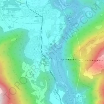
Name: Hinterrhein topographic map, elevation, terrain.
Location: Hinterrhein, Domat/Ems, Imboden, Grisons, 7013, Switzerland (46.78098 9.40398 46.81493 9.41695)
Average elevation: 839 m
Minimum elevation: 587 m
Maximum elevation: 1,506 m
Thank you for supporting this site ❤️
Make a donation
Make a donation
Gear up for your next adventure:
As an Amazon Associate, this site earns from qualifying purchases at no extra cost to you.