
Thank you for supporting this site ❤️
Make a donation
Make a donation
Gear up for your next adventure:
As an Amazon Associate, this site earns from qualifying purchases at no extra cost to you.
Carapungo topographic map
Click on the map to display elevation.
Thank you for supporting this site ❤️
Make a donation
Make a donation
Gear up for your next adventure:
As an Amazon Associate, this site earns from qualifying purchases at no extra cost to you.
About this map
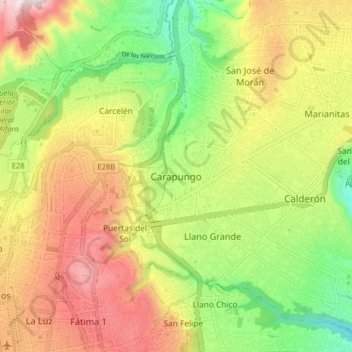
Name: Carapungo topographic map, elevation, terrain.
Location: Carapungo, Calderon, Quito Canton, Pichincha, +573, Ecuador (-0.13836 -78.49312 -0.05836 -78.41312)
Average elevation: 2,694 m
Minimum elevation: 2,376 m
Maximum elevation: 3,055 m
Thank you for supporting this site ❤️
Make a donation
Make a donation
Gear up for your next adventure:
As an Amazon Associate, this site earns from qualifying purchases at no extra cost to you.