
Labacengos topographic map
Interactive map
Click on the map to display elevation.
About this map
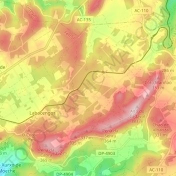
Name: Labacengos topographic map, elevation, terrain.
Location: Labacengos, Moeche, Ferrol, La Coruña, Galicia, 15564, España (43.55271 -7.99758 43.59200 -7.92620)
Average elevation: 252 m
Minimum elevation: 90 m
Maximum elevation: 376 m
Other topographic maps
Click on a map to view its topography, its elevation and its terrain.