
Thank you for supporting this site ❤️
Make a donation
Make a donation
Gear up for your next adventure:
As an Amazon Associate, this site earns from qualifying purchases at no extra cost to you.
Bayas topographic map
Click on the map to display elevation.
Thank you for supporting this site ❤️
Make a donation
Make a donation
Gear up for your next adventure:
As an Amazon Associate, this site earns from qualifying purchases at no extra cost to you.
About this map
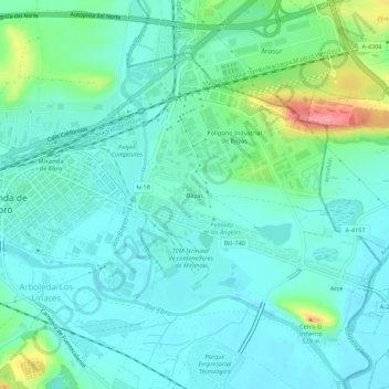
Name: Bayas topographic map, elevation, terrain.
Location: Bayas, Miranda de Ebro, Burgos, Castilla y León, 09200, España (42.66641 -2.94097 42.70641 -2.90097)
Average elevation: 471 m
Minimum elevation: 450 m
Maximum elevation: 547 m
Thank you for supporting this site ❤️
Make a donation
Make a donation
Gear up for your next adventure:
As an Amazon Associate, this site earns from qualifying purchases at no extra cost to you.