Geolocate

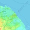
East Ravendale topographic map

Click on the map to display elevation.

About this map

Name: East Ravendale topographic map, elevation, terrain.

Location: East Ravendale, North East Lincolnshire, Greater Lincolnshire, England, United Kingdom (53.46712 -0.14798 53.48972 -0.11238)

Average elevation: 70 m

Minimum elevation: 25 m

Maximum elevation: 101 m

Other topographic maps

Click on a map to view its topography, its elevation and its terrain.
Gear up for your next adventure:

🧼Biodegradable Soaps - Eco‑friendly soap for backpacking
🎒Hiking Backpacks - Durable backpacks for day hikes and multi‑day treks
🧗Rock Climbing Gear - Essentials for the cliffs of Moher or Gap of Dunloe
📡Satellite Messengers - Emergency communication for remote areas without signal
⛺Ultralight Hiking Tents - Compact shelters for multi-day wild camping in Ireland

As an Amazon Associate, this site earns from qualifying purchases at no extra cost to you.