
Coevorden topographic map
Interactive map
Click on the map to display elevation.
About this map
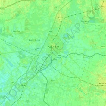
Name: Coevorden topographic map, elevation, terrain.
Location: Coevorden, Drente, Niederlande (52.62676 6.62945 52.67856 6.86188)
Average elevation: 11 m
Minimum elevation: 5 m
Maximum elevation: 20 m
Other topographic maps
Click on a map to view its topography, its elevation and its terrain.
Wachtum
Niederlande > Drente > Coevorden
Wachtum, Coevorden, Drente, Niederlande
Average elevation: 13 m
Diphoorn
Niederlande > Drente > Coevorden
Diphoorn, Coevorden, Drente, Niederlande
Average elevation: 17 m