Geolocate

Bearsden topographic map

Click on the map to display elevation.

About this map
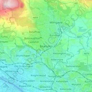
Name: Bearsden topographic map, elevation, terrain.

Location: Bearsden, East Dunbartonshire, Scotland, G61 3RU, United Kingdom (55.88046 -4.37320 55.96046 -4.29320)

Average elevation: 72 m

Minimum elevation: -4 m

Maximum elevation: 354 m

Other topographic maps

Click on a map to view its topography, its elevation and its terrain.

Gear up for your next adventure:

🧥Gore-Tex Rain Jackets - Breathable and fully waterproof shells for Irish weather
🎒Backpack Rain Covers - Extra protection for non-waterproof rucksacks
🧥Packable Down Jackets - High warmth-to-weight ratio for summit breaks
🔧Bicycle Repair Kits - On‑the‑go bike maintenance tools
🎽Thermal Base Layers - Essential moisture management for cold weather

As an Amazon Associate, this site earns from qualifying purchases at no extra cost to you.