
Cluntang topographic map
Interactive map
Click on the map to display elevation.
About this map
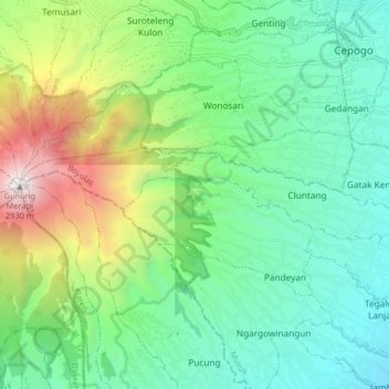
Name: Cluntang topographic map, elevation, terrain.
Location: Cluntang, Musuk, Boyolali, Centraal-Java, Indonesië (-7.55250 110.44620 -7.53321 110.52715)
Average elevation: 1,336 m
Minimum elevation: 689 m
Maximum elevation: 2,920 m