
Inishowen Municipal District topographic map
Interactive map
Click on the map to display elevation.
About this map
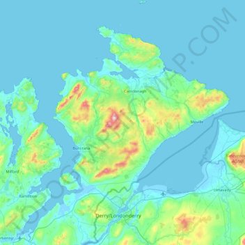
Name: Inishowen Municipal District topographic map, elevation, terrain.
Location: Inishowen Municipal District, County Donegal, Ulster, Ireland (54.93724 -7.58530 55.43530 -6.92273)
Average elevation: 59 m
Minimum elevation: -4 m
Maximum elevation: 609 m
County Donegal trails, hiking, mountain biking, running and outdoor activities
Other topographic maps
Click on a map to view its topography, its elevation and its terrain.