Geolocate

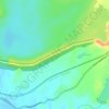
Donwat topographic map

Click on the map to display elevation.

About this map

Name: Donwat topographic map, elevation, terrain.

Location: Donwat, Khalapur Taluka, Raigad, Maharashtra, India (18.75861 73.23259 18.79861 73.27259)

Average elevation: 105 m

Minimum elevation: 62 m

Maximum elevation: 296 m

Other topographic maps

Click on a map to view its topography, its elevation and its terrain.

Khalapur Gaon

India > Maharashtra > Khalapur Taluka

Average elevation: 66 m

Morbe Dam

India > Maharashtra > Khalapur Taluka > Chowk

Average elevation: 61 m

Patalganga

India > Maharashtra > Khalapur Taluka > Jambrung

Average elevation: 95 m

Gear up for your next adventure:

🚨Emergency Whistles - Safety whistles for hikers
📊Altimeters & Barometers - Track elevation and weather changes
🧦Merino Wool Socks - Moisture-wicking and blister-preventing trail socks
🕶️Polarized Sunglasses - Reduce glare from lakes and sea cliffs
🩰Hiking Binoculars - See long distances on trails

As an Amazon Associate, this site earns from qualifying purchases at no extra cost to you.