
Caofeidian District topographic map
Interactive map
Click on the map to display elevation.
About this map
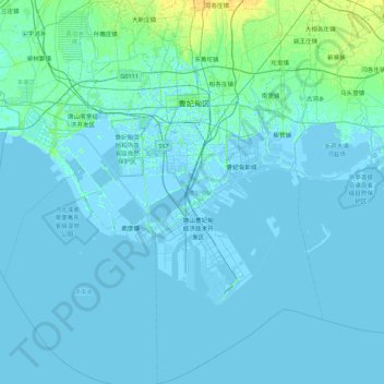
Name: Caofeidian District topographic map, elevation, terrain.
Location: Caofeidian District, Tangshan, Hebei, 063210, China (38.77797 118.13914 39.45163 118.74573)
Average elevation: 1 m
Minimum elevation: -4 m
Maximum elevation: 16 m
Other topographic maps
Click on a map to view its topography, its elevation and its terrain.