
Ballaghaderreen topographic map
Interactive map
Click on the map to display elevation.
About this map
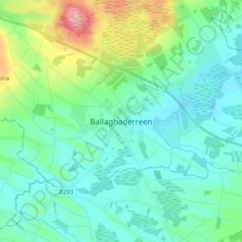
Name: Ballaghaderreen topographic map, elevation, terrain.
Location: Ballaghaderreen, County Roscommon, Connacht, Ireland (53.86137 -8.61886 53.94137 -8.53886)
Average elevation: 97 m
Minimum elevation: 64 m
Maximum elevation: 222 m