
緑区 topographic map
Interactive map
Click on the map to display elevation.
About this map
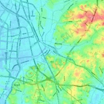
Name: 緑区 topographic map, elevation, terrain.
Location: 緑区, 名古屋市, 爱知县, 日本 (35.03920 136.90579 35.10980 137.02348)
Average elevation: 20 m
Minimum elevation: -4 m
Maximum elevation: 80 m
Other topographic maps
Click on a map to view its topography, its elevation and its terrain.