
Bellver de Cerdanya topographic map
Interactive map
Click on the map to display elevation.
About this map
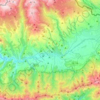
Name: Bellver de Cerdanya topographic map, elevation, terrain.
Location: Bellver de Cerdanya, Cerdanya, Lleida, Catalonia, 25720, Spain (42.28400 1.70857 42.47748 1.82449)
Average elevation: 1,575 m
Minimum elevation: 896 m
Maximum elevation: 2,906 m
Other topographic maps
Click on a map to view its topography, its elevation and its terrain.
Montellà i Martinet
Montellà i Martinet, Cerdanya, Lleida, Catalonia, Spain
Average elevation: 1,534 m