
Bengo Province topographic map
Interactive map
Click on the map to display elevation.
About this map
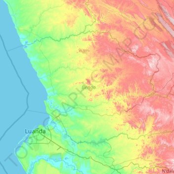
Name: Bengo Province topographic map, elevation, terrain.
Location: Bengo Province, Angola (-8.98071 12.90032 -7.63520 14.98069)
Average elevation: 290 m
Minimum elevation: -1 m
Maximum elevation: 1,171 m
Other topographic maps
Click on a map to view its topography, its elevation and its terrain.