
McDowell County topographic map
Interactive map
Click on the map to display elevation.
About this map
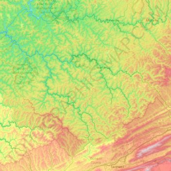
Name: McDowell County topographic map, elevation, terrain.
Location: McDowell County, West Virginia, USA (37.20148 -81.99658 37.54902 -81.30544)
Average elevation: 637 m
Minimum elevation: 247 m
Maximum elevation: 1,352 m
Other topographic maps
Click on a map to view its topography, its elevation and its terrain.
Newhall
USA > West Virginia > Newhall
Newhall, McDowell County, West Virginia, 24866, USA
Average elevation: 623 m
Blue Knob
Blue Knob, Greenbrier County, West Virginia, USA
Average elevation: 1,141 m
Weirton
USA > West Virginia > Weirton
Weirton, Hancock County, West Virginia, USA
Average elevation: 292 m
Rossmore
USA > West Virginia > Rossmore
Rossmore, Logan County, West Virginia, 25636, USA
Average elevation: 376 m