
Thank you for supporting this site ❤️
Make a donation
Make a donation
Gear up for your next adventure:
As an Amazon Associate, this site earns from qualifying purchases at no extra cost to you.
Chedburgh topographic map
Click on the map to display elevation.
Thank you for supporting this site ❤️
Make a donation
Make a donation
Gear up for your next adventure:
As an Amazon Associate, this site earns from qualifying purchases at no extra cost to you.
About this map
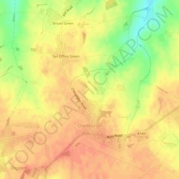
Name: Chedburgh topographic map, elevation, terrain.
Location: Chedburgh, West Suffolk, Suffolk, England, United Kingdom (52.18228 0.60820 52.20470 0.63904)
Average elevation: 115 m
Minimum elevation: 84 m
Maximum elevation: 128 m
Thank you for supporting this site ❤️
Make a donation
Make a donation
Gear up for your next adventure:
As an Amazon Associate, this site earns from qualifying purchases at no extra cost to you.