

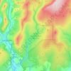
Port Logan topographic map
Click on the map to display elevation.
Port Logan
On 27 July 1944, two Douglas C-47 Skytrains (one was serial number 42-93038) of the United States Army Air Forces were on a flight from Filton to a stop at Prestwick before flying on to the United States. The flight was transporting wounded soldiers. The flight encountered bad weather, and the pilot of 42-93038 tried to gain altitude to clear the cliffs. The C-47 crashed into the cliff side at Port Logan, where all 22 passengers and crew died.
About this map

Name: Port Logan topographic map, elevation, terrain.
Average elevation: 30 m
Minimum elevation: -1 m
Maximum elevation: 118 m
Other topographic maps
Click on a map to view its topography, its elevation and its terrain.
Tarras Valley Nature Reserve
United Kingdom > Scotland > Dumfries and Galloway
Average elevation: 227 m