
Parkton topographic map
Interactive map
Click on the map to display elevation.
About this map
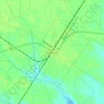
Name: Parkton topographic map, elevation, terrain.
Location: Parkton, Robeson County, North Carolina, United States (34.89430 -79.01957 34.91138 -78.99973)
Average elevation: 56 m
Minimum elevation: 48 m
Maximum elevation: 60 m
Other topographic maps
Click on a map to view its topography, its elevation and its terrain.
Maxton
United States > North Carolina > Robeson County
Maxton, Robeson County, North Carolina, United States
Average elevation: 58 m
Lumberton
United States > North Carolina > Robeson County
Lumberton, Robeson County, North Carolina, United States
Average elevation: 42 m
Rowland
United States > North Carolina > Robeson County > Rowland
Rowland, Robeson County, North Carolina, United States
Average elevation: 45 m