
Thank you for supporting this site ❤️
Make a donation
Make a donation
Gear up for your next adventure:
As an Amazon Associate, this site earns from qualifying purchases at no extra cost to you.
Santhanpara topographic map
Click on the map to display elevation.
Thank you for supporting this site ❤️
Make a donation
Make a donation
Gear up for your next adventure:
As an Amazon Associate, this site earns from qualifying purchases at no extra cost to you.
About this map
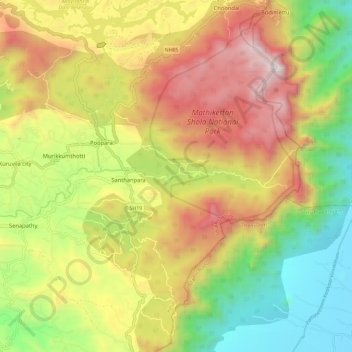
Name: Santhanpara topographic map, elevation, terrain.
Location: Santhanpara, Poopara, Udumbanchola, Idukki, Kerala, India (9.90962 77.16552 10.02371 77.27289)
Average elevation: 1,111 m
Minimum elevation: 404 m
Maximum elevation: 1,941 m
Thank you for supporting this site ❤️
Make a donation
Make a donation
Gear up for your next adventure:
As an Amazon Associate, this site earns from qualifying purchases at no extra cost to you.