
Thank you for supporting this site ❤️
Make a donation
Make a donation
Gear up for your next adventure:
As an Amazon Associate, this site earns from qualifying purchases at no extra cost to you.
Ancobamba topographic map
Click on the map to display elevation.
Thank you for supporting this site ❤️
Make a donation
Make a donation
Gear up for your next adventure:
As an Amazon Associate, this site earns from qualifying purchases at no extra cost to you.
About this map
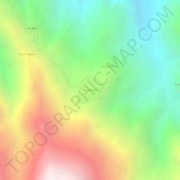
Name: Ancobamba topographic map, elevation, terrain.
Location: Ancobamba, Chapimarca, Aymaraes, Apurímac, Perú (-14.03759 -73.10286 -14.03321 -73.09854)
Average elevation: 3,585 m
Minimum elevation: 3,056 m
Maximum elevation: 4,253 m
Thank you for supporting this site ❤️
Make a donation
Make a donation
Gear up for your next adventure:
As an Amazon Associate, this site earns from qualifying purchases at no extra cost to you.